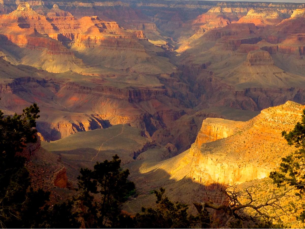
You're sitting in a swanky Scottsdale cafe, sipping an iced latte, and looking at the red rocks in the distance. Suddenly, you think, "I should just drive to the Grand Canyon." It seems close. Arizona is just one big desert, right? Well, sort of. But the actual distance from Scottsdale to Grand Canyon is a bit more involved than a quick jaunt across town. If you don’t plan it right, you’ll end up spending seven hours in a car just to see a big hole in the ground for twenty minutes before it gets dark.
I’ve done this drive more times than I can count. Honestly, the mileage is only half the story. The elevation change, the traffic through Black Canyon City, and the literal temperature swings are what actually define the trip.
The Raw Numbers: How Far Are We Talking?
Let's get the math out of the way first. If you’re heading to the South Rim—which is where 90% of people go—the distance from Scottsdale to Grand Canyon is roughly 230 to 240 miles.
It depends on where in Scottsdale you’re starting. If you’re up in North Scottsdale near Troon North, you’ve got a slight head start. If you’re down in Old Town, add another fifteen minutes of stop-and-go traffic before you even hit the 101. On a good day with no construction, you’re looking at about 3.5 to 4 hours of pure driving time.
But here’s the kicker: The North Rim is a totally different beast. Even though it looks close on a map, the distance jumps to about 350 miles. You have to drive all the way around the canyon to get there. That’s a 6-hour commitment. Most people make the mistake of thinking they can "swing by" both in a weekend. You can't. Not unless you enjoy living in your driver's seat.
The I-17 Factor: More Than Just a Highway
The route is basically a straight shot up Interstate 17 until you hit Flagstaff. It sounds easy. It’s not. You start at an elevation of around 1,200 feet in Scottsdale. By the time you hit Flagstaff, you’re at 7,000 feet. Your car’s engine is going to feel that. Your ears are going to pop.
The I-17 is notorious. It’s a winding, steep climb that locals affectionately (or not so affectionately) call "The Hill." Between Sunset Point and Cordes Junction, the road twists through the mountains with some pretty aggressive grades. If you’re behind a semi-truck going 30 mph, your "4-hour drive" just became 5.
I always tell people to check the ADOT (Arizona Department of Transportation) alerts before leaving. A single accident on the I-17 can shut down the whole north-bound flow for hours because there aren't many alternative routes through the canyons.
Where Most People Get the Route Wrong
Most GPS apps will tell you to take I-17 to Flagstaff, then jump on the I-40 west to Williams, and finally take Highway 64 north. This is the "standard" way. It’s fine. It’s reliable.
However, if you want a more scenic vibe, take US-180 out of Flagstaff instead. It cuts through the Coconino National Forest. You’ll see towering Ponderosa pines and the San Francisco Peaks. It’s roughly the same distance from Scottsdale to Grand Canyon, maybe a few miles longer, but the "mental distance" feels shorter because you aren't staring at the back of a Greyhound bus on the interstate.
Timing the Departure
Don't leave at 8:00 AM on a Saturday. Just don't. You’ll be fighting every other tourist and local heading to the high country to escape the Phoenix heat. If you can, leave at 5:00 AM. You’ll catch the sunrise over the Bradshaw Mountains, and you’ll actually get to the park gates before the three-mile-long line forms at the South Entrance.
Weather is a Real Variable Here
In Scottsdale, it might be 105 degrees. You’re in shorts and a tank top. You think, "Great, desert weather."
Wrong.
The Grand Canyon is high altitude. It is consistently 20 to 30 degrees cooler than Scottsdale. I’ve seen tourists show up at Mather Point in July wearing flip-flops and sundresses, only to be shivering because a storm rolled in and the temperature dropped to 65 degrees in ten minutes. The distance from Scottsdale to Grand Canyon isn't just a horizontal measurement; it's a vertical one. Pack a jacket. Seriously.
Fuel, Food, and Sanity Checks
You’ll pass through a few key spots.
- New River: Last chance for "city" gas prices.
- Rock Springs: Stop here. Get the pie. The Jack Daniel’s Pecan pie is legendary. It’s a tourist trap, sure, but it’s a delicious one.
- Flagstaff: This is your halfway-ish point. It’s a great place to stretch your legs. If you need a real meal, Mother Road Brewing Co. is a solid choice, though it might make you want to stay in Flagstaff instead of finishing the drive.
- Williams: Known as the "Gateway to the Grand Canyon." This is where the Grand Canyon Railway departs. If you’re tired of driving, you can actually park here and take the train the rest of the way. It adds time, but it subtracts stress.
Is a Day Trip Actually Doable?
Technically, yes. Is it fun? Debatable.
If you leave Scottsdale at 5:00 AM, you get to the canyon by 9:00 AM. You spend six hours hiking a bit of the Bright Angel Trail, grabbing some overpriced cafeteria food at Maswik Lodge, and taking 400 photos of the same rock formation. You leave at 4:00 PM and get back to Scottsdale by 8:00 PM.
That’s 8 hours of driving for 6 hours of sightseeing. It’s a long day. If you’re determined to do it, make sure you have a playlist that lasts at least five hours. If you have the time, staying overnight in Tusayan (just outside the park) or Flagstaff makes the distance from Scottsdale to Grand Canyon feel much more manageable.
The Helicopter Shortcut
Some people ask about flying. There are tours that depart from the Scottsdale Airport (SDL) or the Deer Valley Airport. You’re looking at about 45 minutes in the air. It’s stunning. You see the Tonto National Forest and the Red Rocks of Sedona from above. It’s also significantly more expensive than a tank of gas. But if "time is money" is your mantra, this is the only way to bypass the I-17 slog.
Practical Steps for Your Trip
Don't just wing it. Arizona is beautiful but it can be unforgiving if you're unprepared.
- Download Offline Maps: Cell service is non-existent for long stretches between Flagstaff and the South Rim. Don't rely on a live data connection.
- Hydrate Early: You are going to high altitude. If you start drinking water when you get there, it’s too late. Drink a liter of water during the drive.
- The "Secret" Entrance: If the South Entrance (near Tusayan) has a massive wait, consider driving east out of Flagstaff on US-89 and entering through the Desert View Watchtower entrance. It adds about 20 minutes to your drive time, but can save you an hour of idling in line at the main gate. Plus, the view from Desert View is arguably better for your first glimpse of the Colorado River.
- Buy Your Pass Online: Save yourself the hassle at the booth. Have your digital or printed National Park pass ready to go.
- Check Your Tires: The heat on the road from Scottsdale and the steep climbs put a lot of stress on your rubber. Blowouts on I-17 are extremely common in the summer.
The distance from Scottsdale to Grand Canyon is a rite of passage for anyone visiting Arizona. It's a transition from the manicured lawns and golf courses of the Valley to one of the rawest, most humbling landscapes on earth. Just remember: it's a marathon, not a sprint. Take your time, eat some pie in Rock Springs, and keep an eye on your gas gauge.